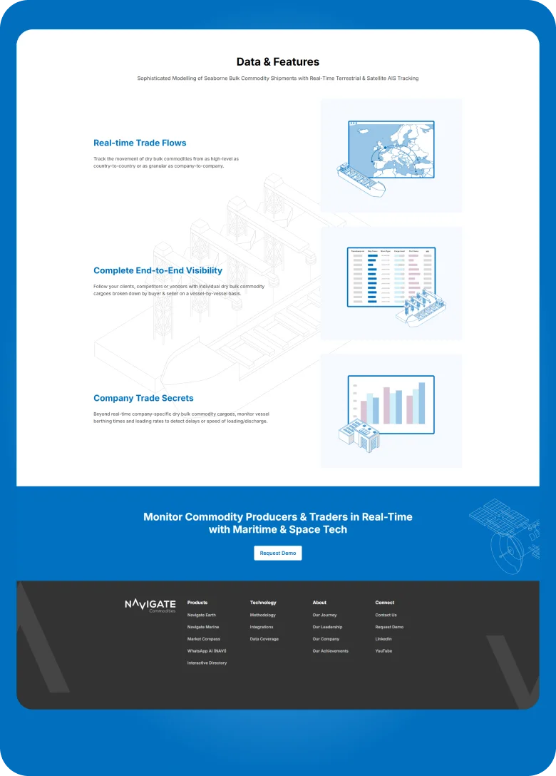
MWAN as a trusted partner, Developed Powerful Proprietary Maritime & Satellite technology that enables you to monitor real time the movement & consumption of dry bulk commodities over land & sea helping commodity professionals identify real-world opportunities by revealing company-specific real-time trade and smelting activity.
Very High-Resolution (VHR) Optical Satellite Imagery
Scalable AI/ML processing of near real-time VHR optical satellite imagery to monitor the expansion or contraction of bulk commodity stockpiles across the world.
Terrestrial AIS and Satellite AIS (SAT-AIS)
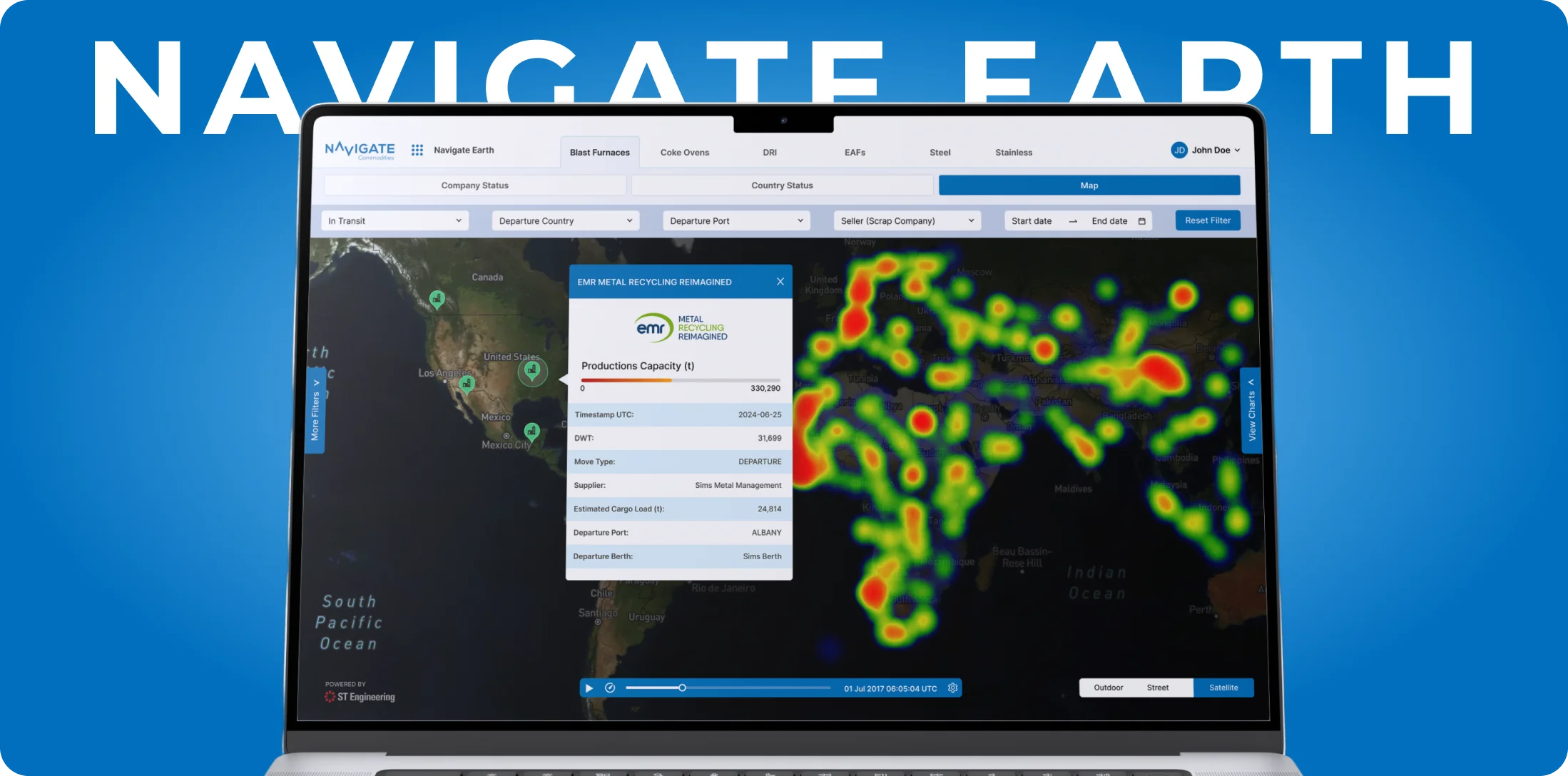
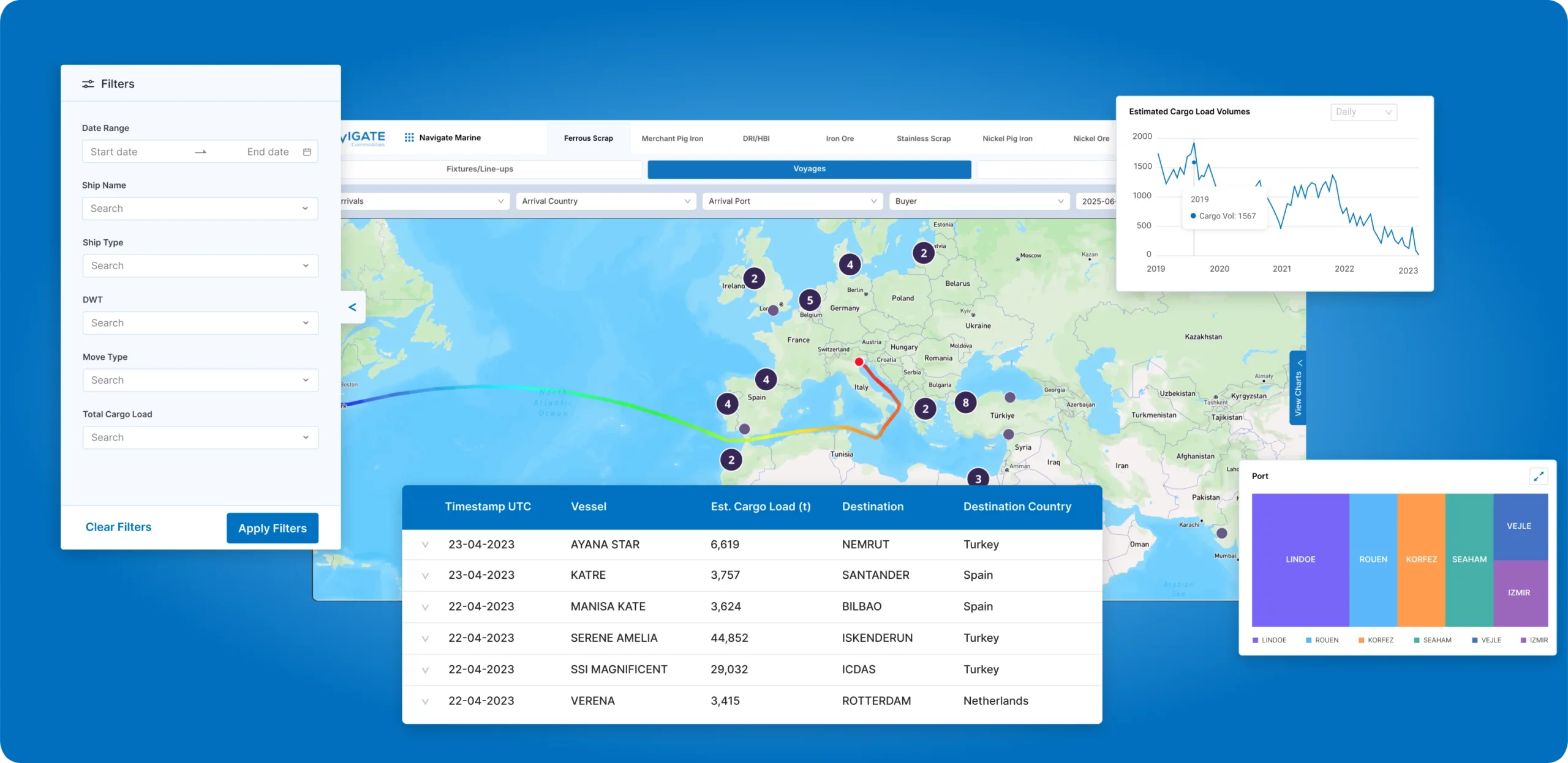
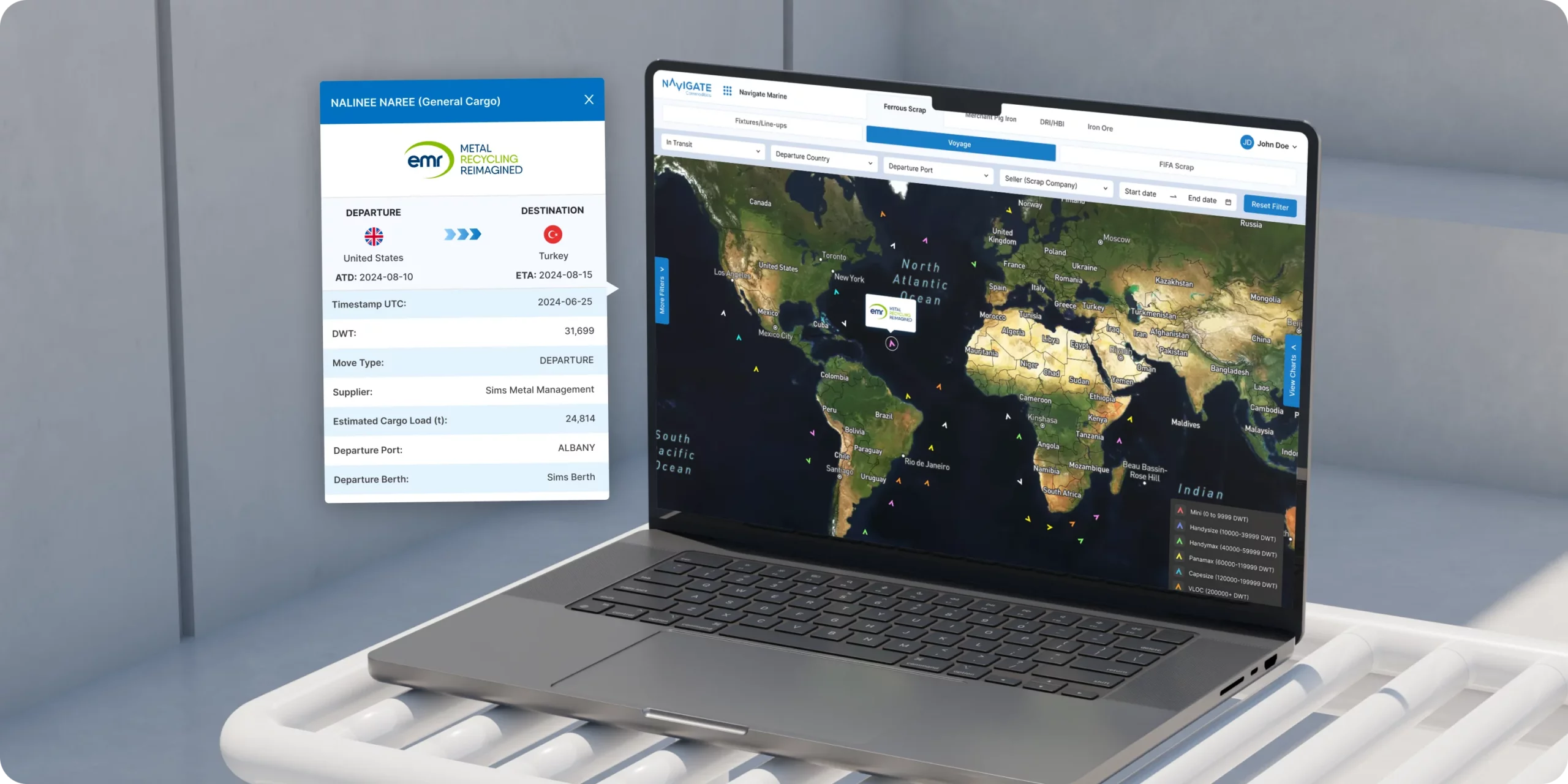
Ultra-High-Frequency monitoring of company-specific dry bulk commodity seaborne shipments that tracks buyer/seller, payloads, berthing times, and loading rates.
Thermal Infrared Satellite Imagery (TIRS)
Scalable AI/ML processing of near real-time thermal infrared satellite imagery to monitor the almost daily activity of global company-specific metal smelters.
Smelter Inactivity
Monitor which of your clients or competitors have idled (short-term), undergone maintenance (medium-term) or shut down (long-term) operations in real-time.
Productivity & Utilization
Track production & capacity utilization rates of individual company-specific metal smelters and their site-specific equipment i.e. blast furnaces & sinter plants.
Raw Materials Demand
Derive real-time demand for raw materials based on high-frequency thermal infrared activity of your target metal smelter(s).
 React Native
 Figma
Figma
 Laraval